Client: Tacoma-Pierce County Health Department
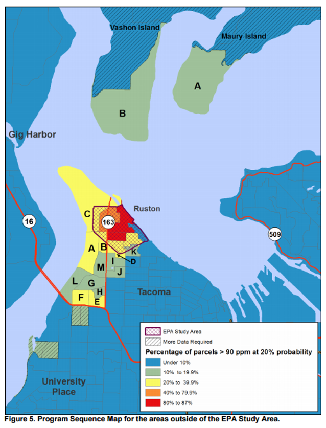
For almost 100 years, the Asarco Company operated a copper smelter in Tacoma, Washington State. Air pollution from the smelter settled on the surface soil over more than 2,600 square kilometers of the Puget Sound basin. As part of the Tacoma Smelter Plume project, there have been a number of studies looking at soil arsenic contamination, leading to the collection of more than 5,000 surface soil samples over the years. The present study aimed to pool all of the sampling results to create a model that can be used to further prioritize areas for additional sampling and remediation since not enough money is available to clean all residential parcels.
The objectives of this sub-contract were:
A geostatistical approach was developed and implemented to: 1) incorporate wind rose information, elevation and field measurements in the geostatistical mapping of arsenic concentration estimates at the parcel level, and 2) compute the probability of exceeding specific arsenic levels at the parcel and block-group levels. A computer program was also written to allow the client to derive the probability that a fraction X of the parcels within any given block group exceeds a given Threshold T. Both parameters X and T are specified by the user who can choose multiple fractions and thresholds per run.
Goovaerts, P. 2012. TSP Mapping Project: Development of a geostatistical mapping methodology. Final report Available as attachment 2 of Final Program Design and Implementation Plan at https://fortress.wa.gov/ecy/publications/documents/1309081.pdf
Goovaerts, P. and G. Glass. 2014. Geostatistical modeling of the spatial distribution of surface soil arsenic around a smelter. Journal of the Japanese Society of Soil Physics, 128, 5-10.