Client: Abt Associates (formerly Stratus Consulting)
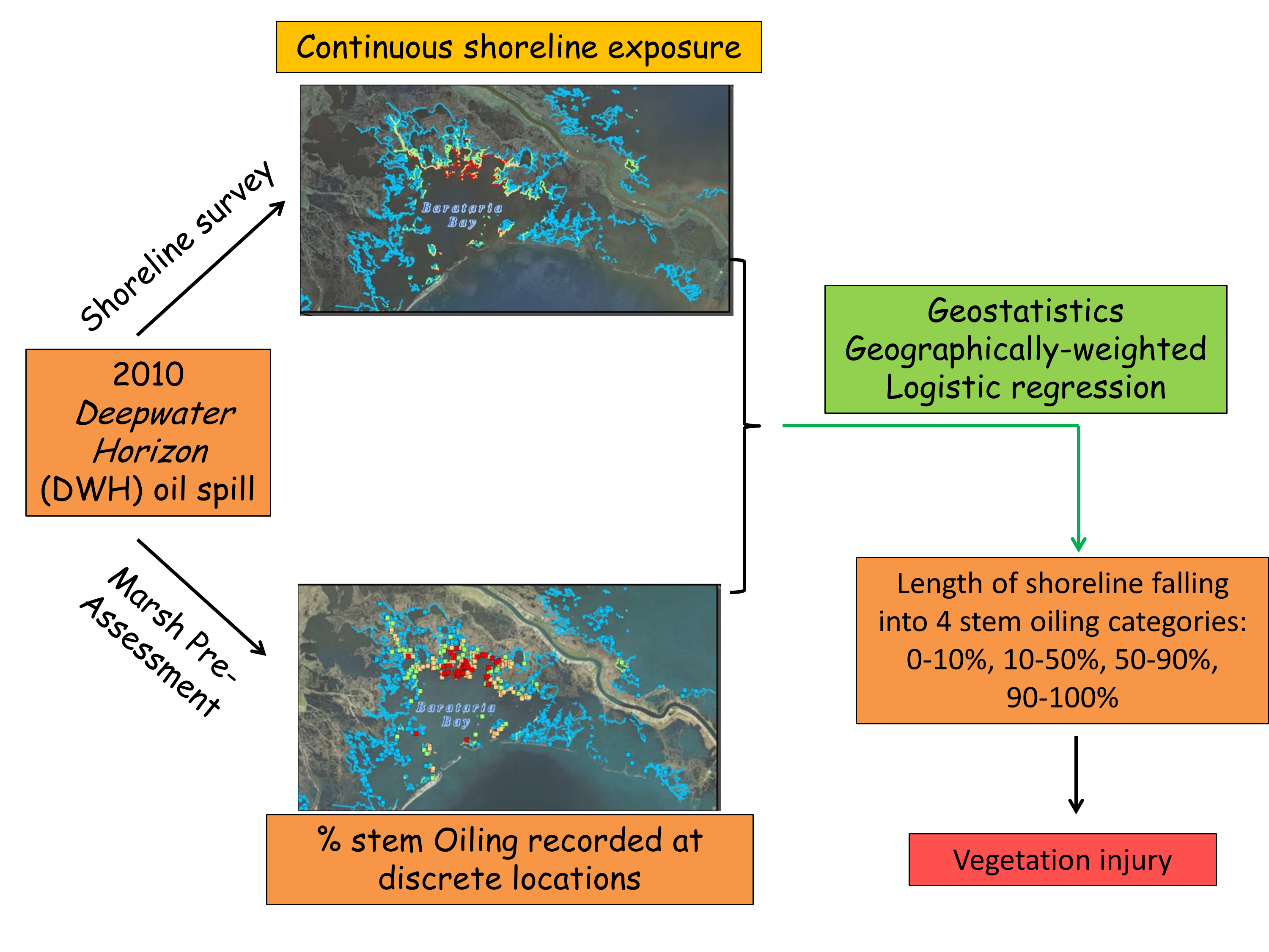
Stranded oil covering soil and plant stems in fragile Louisiana marshes was one of the most visible impacts of the 2010 Deepwater Horizon (DWH) oil spill. As part of the assessment of marsh injury after the DWH spill, plant stem oiling was broken into five categories (0%, 0-10%, 10-50%, 50-90%, 90-100%) and used as the independent variable for estimating death of vegetation, accelerated erosion, and other metrics of injury. The length of shoreline falling into each of these stem oiling categories is therefore a key measure of the total extent of marsh injury.
The main objective was to assist Stratus Consulting in developing estimates of the spatial extent and degree of oiling along Louisiana shorelines resulting from the Deepwater Horizon oil spill.
A methodology was developed to account for inconsistent data quality, heterogeneous field conditions, and complex geometries in the extrapolation of field observations into continuous measures of natural resource damages. The total length of oiled mainland herbaceous shoreline is estimated to be 1,161 km, with 29% (334 km) falling into the two upper classes of stem oiling (i.e. > 50% stem oiling).
Goovaerts, P., Wobus, C., Jones, R., and M. Rissing. 2016. Geospatial estimation of the impact of Deepwater Horizon Oil Spill on plant oiling along the Louisiana shorelines. Journal of Environmental Management, 180(15): 264-271.