Client: Computer Science Corporation
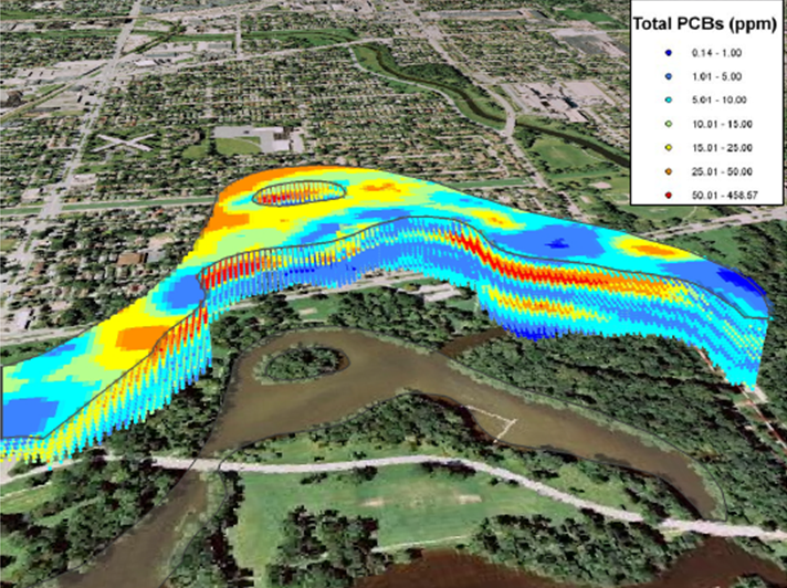
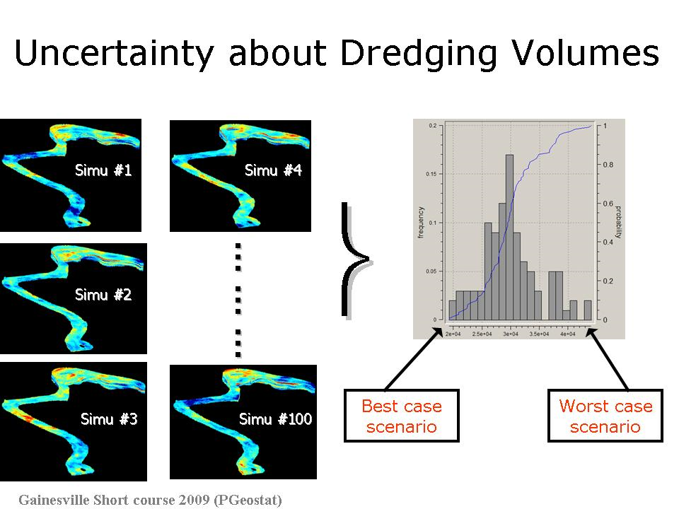
In the environmental industry, sediment remediation projects often involve dredging and removal of contaminated sediments. The volume of sediment targeted for removal must be estimated prior to the project to identify appropriate dredging equipment and ensure sufficient disposal options. These volumes also are often used in remedial contracts to develop and monitor achievement of project goals and assess payment. Over- or under-estimating these volumes can have significant adverse impacts on the project scope, budget, and schedule. It is therefore imperative to make as accurate an estimate as possible of sediment volumes targeted for removal. Site complexity and data scarcity often result in significant uncertainty about the spatial distribution of the contaminant of concern, which translates into uncertain volume estimates. This fact is being increasingly acknowledged by practitioners as they trade single estimates computed using deterministic methods (e.g., inverse distance weighting) for probabilistic assessment based on geostatistical models. Yet, the application of geostatistics to sediment data poses significant challenges that are often overlooked and can lead to vastly different estimates.
Dr. Goovaerts has worked on multiple sites distributed across the Great Lakes Region, including the Buffalo River, the Lower Rouge River, Kinnickinnic River, Ottawa River, Ruddiman Pond, Trenton Channel, Hog island inlet, Division Street Outfall, Lincoln Park. The objectives included:
Geostatistics provides a wide range of tools to accommodate the complexity of sediment data and model the uncertainty attached to any dredging scenario. Despite recent attempts to automate the geostatistical characterization of contaminated sediments, expert knowledge is critical to tailor these tools to the characteristics of each site. Visual exam of the 3D model and computation of cross-validation statistics, such as the correlation between estimated and observed data, the proportion of samples wrongly classified as exceeding the threshold of concern, or comparison between expected and observed coverage probabilities in the accuracy plot, should also be used to detect any systematic bias in the procedure.


Goovaerts, P., Schofield, J., and J. Telech. 2009. Geostatistical estimation of contaminated sediment volumes: Review of common challenges and solution. Proceedings of StatGIS 2009, Milos, Greece.
In the last five years, PGeostat LLC has worked with GEI on the geostatistical characterization of PCB-contaminated sediments in the Kalamazoo River, estimation of volumes of sediments to be dredged with the associated uncertainty, design of sampling schemes and remediation strategies. More recently, we started collaborating with CDM on the characterization of contaminated sediments and outfalls in Newtown Creek.