Background
The client inherited a couple of lots that with elevated levels of lead and arsenic in soil caused by the use of these lots as storage yard for damaged automobiles and the earlier presence of a car garage with a 250-gallon underground gasoline tank.
Objectives
The overall objective of the project was:
- To establish the range of background (BG) arsenic concentrations in soil on the property and determine the threshold or site-cleanup level to be used in the geostatistical delineation of contaminated areas.
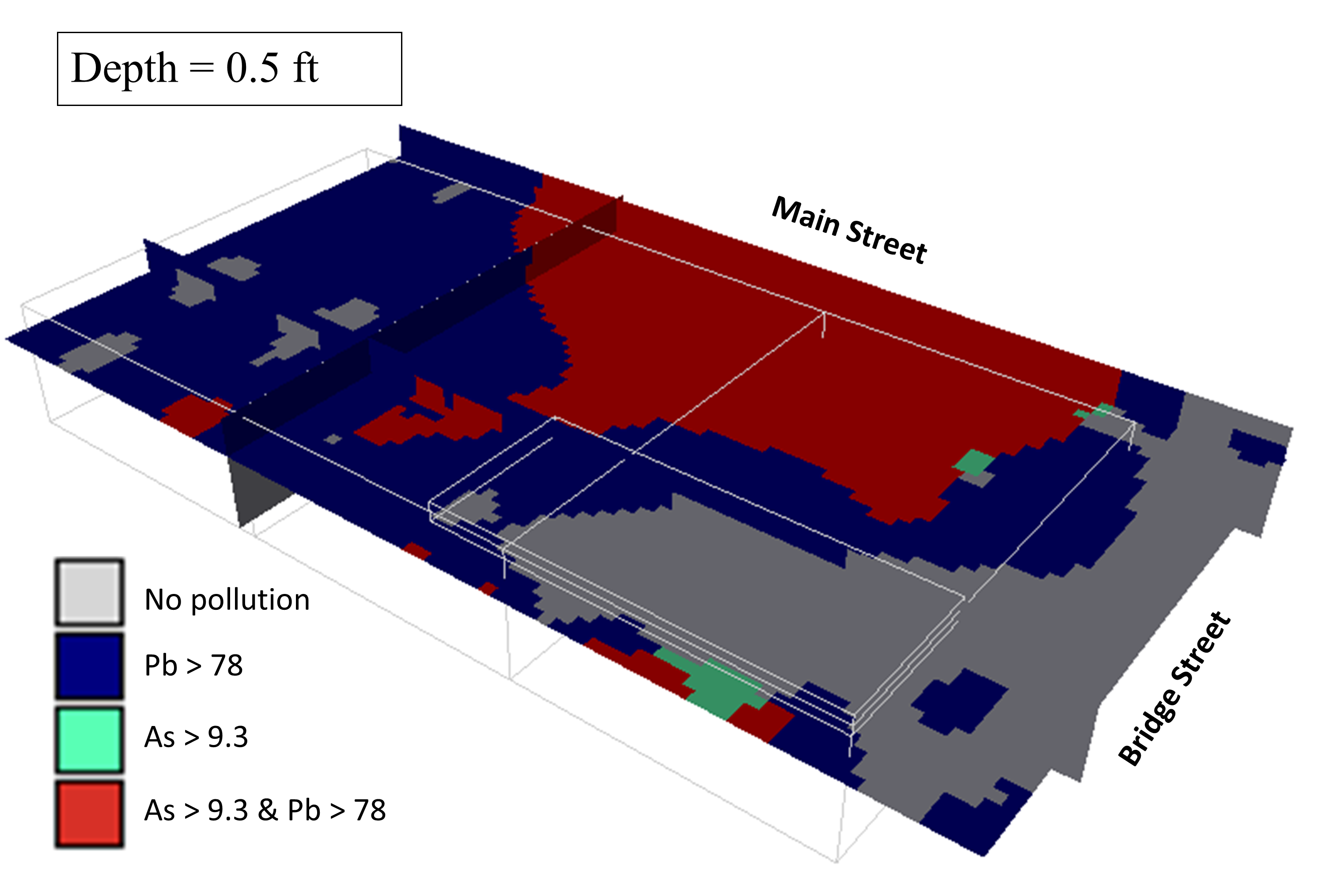
- To map the maximum depths at which arsenic and lead in soil exceed their background levels on the property.
Results
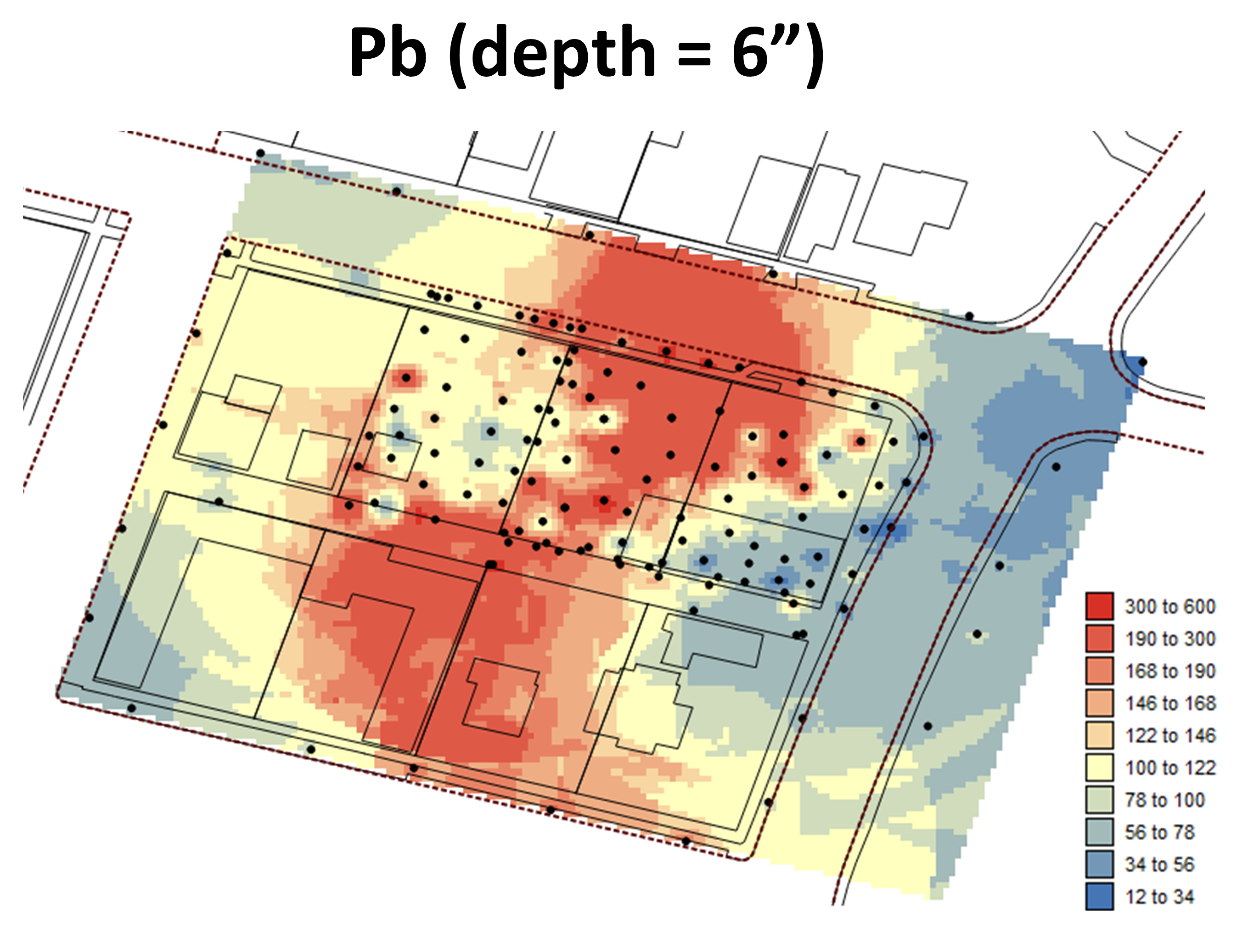
- The three-dimensional distribution of high concentrations is clearly different for the two heavy metals: 1) Lead contamination is the most widespread in terms of impacted surface area, yet it is usually confined to the first six inches, 2) Arsenic contamination spreads much deeper (up to 30 inches) but is found mainly on the Northern side of Lots 1 & 2, beneath the sidewalk on Main Street and in the alley.
- Setting the lead threshold of concern (TOC) to the background level of 29.78 mg/kg instead of the California Human Health Screening Level (CHHSL) of 80 mg/kg essentially results in declaring contaminated a larger percentage of the upper soil layer (first six inches) at the former location of the concrete pad.