Thematic Soil Mapping
Thematic Soil Mapping and Crop-Based Strategies for Site-Specific Management
Client: University of Nebraska, Lincoln
Background
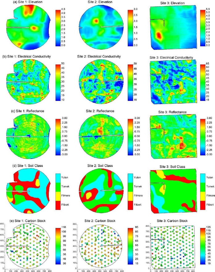
Maps of soil organic carbon (SOC) or soil organic matter (SOM) are of interest for agricultural management as well as in environmental research related to terrestrial sequestration of atmospheric carbon. Several previous studies have illustrated the potential for utilizing exhaustive secondary information such as terrain indices or remote sensing for making more precise maps of SOC or SOM. However, most studies have been conducted at a single site and they were restricted to using single or few ancillary variables, which makes it difficult to assess the robustness of the procedures evaluated. No studies have been conducted to evaluate hybrid geostatistical techniques for mapping of SOC at multiple sites using similar sampling intensities and the same independently measured sources of multivariate secondary information.
Objectives
The overall objective of the project was to increase the efficiency of site-specific management of primary plant nutrients and other soil properties and thereby increase the profitability of farming and decrease negative environmental impact. My main duties involved the development of advanced geostatistical techniques for soil mapping at high spatial resolution, accounting for multiple sources of secondary information such as digital elevation model or thematic maps.
Results
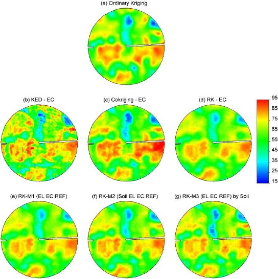
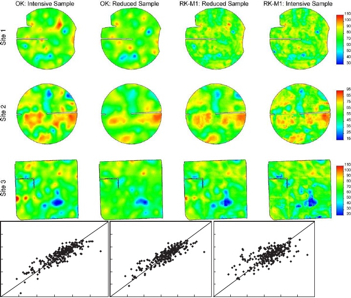
Geostatistical methods that utilized spatially correlated secondary information increased the quality of maps of soil organic carbon stock as compared to univariate ordinary kriging (OK). Regression kriging with electrical conductivity (EC) as secondary information performed better than ordinary kriging (OK), kriging with an external drift (KED), or cokriging. Multivariate regression kriging with elevation, apparent EC, reflectance, and soil series performed best in terms of increasing map accuracy. Soil EC measured on-the-go was the most valuable secondary data source for detailed mapping of soil organic carbon stock at the field scale, whereas the relative value of terrain attributes or satellite imagery varied by sites. Relying on a single secondary attribute is risky because (i) the variable chosen may not be related to the primary variable of interest and (ii) field artifacts or errors in the secondary information could cause significant errors in the carbon stock prediction. To reduce uncertainties, we recommended using independently measured, multivariate secondary information in regression kriging.
Publications
- Simbahan, G.C., Dobermann, A., Goovaerts, P., Ping, J., and M.L. Haddix. 2006. Fine-resolution mapping of soil organic carbon based on multivariate secondary data. Geoderma, 132, 471-489.